
Preliminary Considerations
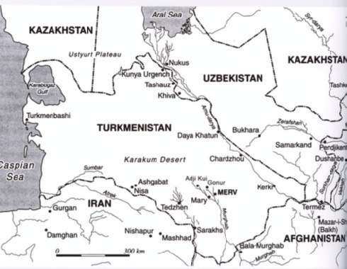
Geographical Situation
Only 5 of the 9 mounds (depe) identified by Masimov between 1974 and 1975 now remain: that is, from N to S, AK8, AK1, AK9, AK4 and AK5. The area has been revisited more recently by researchers from the IsMEO (now IsIAO) as part of the AMMD project which, by only keeping in part Masimov's nomenclature for the sites, have involuntarily complicated the general picture. In fact, they grouped together AK2, AK3, AK4 under n.413 and designated AK8 as n.412. AK9 was not mentioned, while we can only infer that the description of AK1 corresponds to n. 406. Missing from the list are AK5, AK6, AK7, AK9, AK1O, while a further 18 sites defined as "anonymous" are added: 407, 408, 409, 410, 411,418, 419, 420, 421,436, 437,630, 631, 707, 708, 709, 746 e 747.
It is difficult to say whether this last list is in some way identifiable with Masimov's sites or whether they represent an extension of some other site noted by him, since their geographical position is expressed by the transverse UTM kilometric system. This is a system which is only used in Turkmenistan by the army and which poses various problems for most researchers.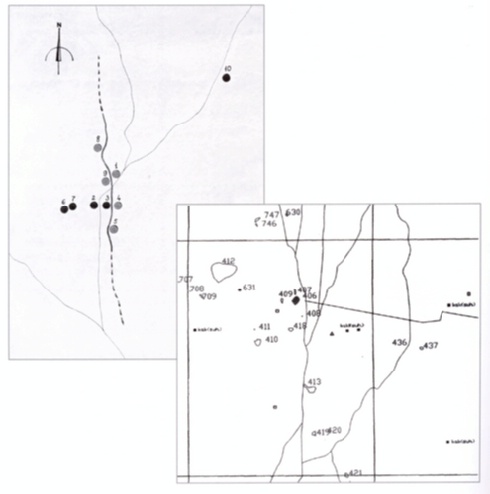
Distribution of oasis settlements according to Masimov and also to the AMMD of IsIAO (below).
Therefore, in order to facilitate the tracing of these sites, I offer a list taken from the general catalogue of the AMMD, and also a comparison table in which I have translated the UTM positions into normal geographical coordinates.
The area currently being investigated by our mission is described in a land register map attached to the excavation concession issued to us by the Ministry of Culture in 2001, which identifies the site of Adji Kui 1 (AK1) by the oasis of the same name with the following geographical coordinates: 38°13'744 N e 61052'956 E.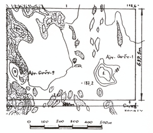
Survey map of the archaeological concession in Adji Kui.
In Turkmen, Adji Kui means "bad water", a name linked to the peculiarities of a very deep well (about 20 metres) situated in the archaeological context of AKI, a few metres from the walls of the acropolis. According to our observations, it would seem that this well has been used at least three times in the present age, the most recent being no more than a decade ago, as can be inferred by a few inscriptions scratched on the robust cement pipes.
The presence, further to the south, of another cistern from the Seljuk period, which we discovered connected to a large domed furnace by means of a canal protected by square tiles, would suggest that in a not too distant past there was an abundance of water at AK1.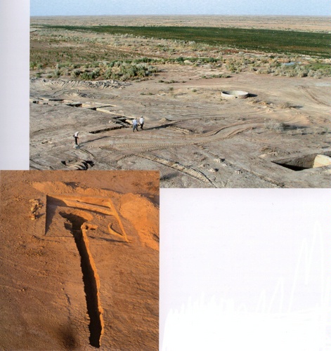
Above: E side of the tepe of AK1 with modern well and, below, the ancient well seen from above.
This would seem to confirm the use of the oasis of Adji Kui in historical times as a staging post along the Silk Road, connecting Merv to the Amu-Darya via Daya-Katin and Konya Keneurgench, in line with studies made by E. Atagarryev and T. Khodzhaniyazov (see btto.). Total abandonment of the site, in all probability, occurred during the incursions of Genghis Khan, who fell on Merv more than once. These raids are, according to historians, the spark which led to a process of desertification which, up to then, had remained more or less under control.
However, even after then, at least one well must have remained active for the use of shepherds. But the water quality gradually worsened, partly because of the saltpetre that had contaminated the whole oasis, partly because some animal fell into it. The well is no longer used today.
(ibid., p. 21-26)
Source: Rossi Osmida, G.: Adji Kui Oasis.Vol.I: The Citadel of the Figurines.Venice: Il Punto Edizioni 2007.